

Read More








Morning Recap - October 27, 2026
7 hours ago


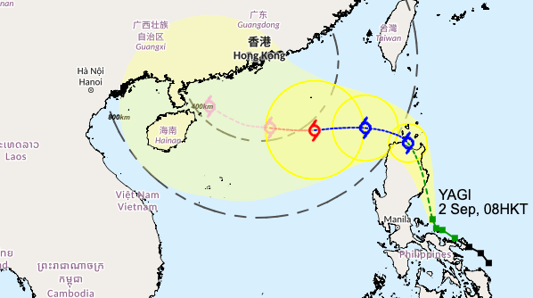
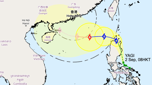
The Observatory said on Monday it will consider issuing the Standby Signal No. 1 between Tuesday afternoon and night, as Tropical Cyclone Yagi will enter within 800 kilometers of the city tomorrow and then edge close to the coast of southern China.
Whether a higher Tropical Cyclone Warning Signal to be issued depends on the intensity, circulation size of Yagi and its distance from Hong Kong, said the weather watchdog.
Yagi was centred about 210 kilometres northeast of Manila and moved towards the northern part of Luzon and intensified in the past few hours.
The Observatory forecasted Yagi will move north-northwest at about 18 kilometres per hour towards the vicinity of the northern part of Luzon, before entering within 800 kilometers of Hong Kong tomorrow and then edge close to the coast of southern China.
“It has a higher chance to move towards the vicinity of the western part of Guangdong and Hainan Island and further intensify.
“Under its influence, the weather over the coast of Guangdong will deteriorate in the latter part of this week with winds strengthening. There will be heavy squally showers and swells. Members of the public should take note of the latest weather forecast,” said the Observatory.
It expects Yagi to be upgraded to severe typhoon on Friday (Sept 6) with 175 km/h maximum sustained wind near the center and skirting within 400 kilometers south of Hong Kong.
(Updated at 3.24 pm)