Read More


Night Recap - April 3, 2026
1 hour ago


Taxi e-payment ‘3pc fee’ notices spark debate on rollout day
02-04-2026 12:42 HKT


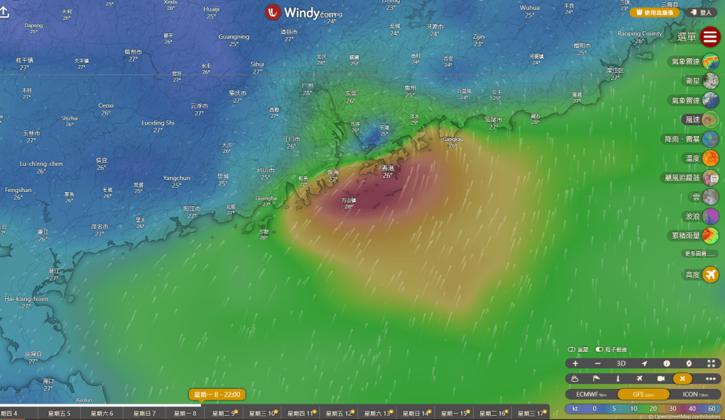
The weather is going to worsen by the end of the week as a potential tropical cyclone is approaching the city, expected to prompt increased showers with squally thunderstorms next week.
The Observatory said a developing weather system poses potential tropical threats to the South China Sea.
However, the weather watchdog noted that the subsequent movement of the broad trough of low pressure remains uncertain, with a higher likelihood of it shifting towards the western coast of Guangdong and the vicinity of Hainan Island.
According to the Observatory's AI prediction system "Fengwu," the tropical cyclone is expected to form in the South China Sea within Thursday (Sep 4) or Friday (Sep 5) and may approach Hainan Island.
It is predicted that the cyclone may come closest to Hong Kong on Sunday (Sep 7), potentially passing southwest of the city to make landfall.
In a notable update from Tuesday's (Sep 2) forecast, the Observatory has raised the wind levels, with Force 6 winds — classified as "strong winds" on the Beaufort scale — expected in offshore and highland areas between September 7 and 8.
Additionally, next week's weather is anticipated to be unstable, with additional showers and squally thunderstorms.
Similarly, the US Global Forecast System predicted that the storm would enter the South China Sea between September 7 and 9, nearing Hong Kong on September 8, with a potential landfall near Yangjiang in Guangdong.
Meanwhile, the European Centre for Medium-Range Weather Forecasts (ECMWF) anticipated the cyclone may approach the city between September 5 and 8, with its closest point on September 7, followed by similar predictions of making landfall to the west of Hong Kong.
As these current predictions should be taken as reference only, forecasters advise the public to stay updated with the latest weather news.