Read More













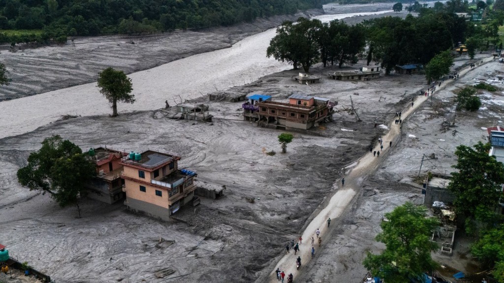
The catastrophic floods and debris flows that regularly tear through the steep river valleys between the Tibetan Plateau and Nepal offer an urgent warning of an escalating environmental crisis. Transboundary river basins originating high on the Tibetan plateau – including the Bhote Koshi, Trishuli, and Arun – have become perilous conduits for flash floods and glacial lake outburst floods.
These violent events occur when rapidly melting glaciers fill high-altitude lakes until their natural barriers of loose rock and ice suddenly give way. The resulting wall of water and debris sweeps down narrow gorges, obliterating riverside villages, severing vital trade routes like the Friendship Highway, and crippling essential hydropower plants.
At the local level, these recurring emergencies offer critical lessons in cross-border disaster management. Viewed broadly, however, they reveal the dangerous destabilization of the "Third Pole" under accelerating global climate change.
At the operational frontline, managing transboundary flood risks has proven that real-time, cross-border communication is a matter of immediate survival. Because vulnerable glacial lakes and river headwaters are located high in Tibet while downstream communities and roads lie across the border in Nepal, the time between a mountain lake bursting and the flood hitting residential areas is measured in minutes.
Practical, tech-driven flood prevention efforts can save lives when neighboring authorities cooperate. By installing automated water-level sensors upstream in Tibet and connecting their data directly to Nepalese disaster management agencies, authorities can trigger warning sirens along riverbanks and send instant text alerts to residents' mobile phones before the surge arrives.
Alongside early warnings, mountain infrastructure engineering has undergone a fundamental redesign. Traditional bridges and roads built to historical flood baselines cannot survive the immense kinetic force of water mixed with mud and giant boulders. In response, engineers are taking proactive preventive measures. Teams are siphoning and pumping water out of dangerously swollen glacial lakes through artificial spillways to lower water levels safely before a breach occurs. Further downstream, authorities are constructing reinforced stone-and-steel check dams across mountain riverbeds to trap heavy boulders, while rebuilding key border checkpoints and bridges – such as those at Tatopani and Rasuwagadhi – at elevations far above historical high-water marks.
Yet localized engineering measures address only the immediate symptoms of a much wider planetary transformation. The Hindu Kush Himalaya region – often called the Third Pole because it holds more ice than anywhere outside the Arctic and Antarctic – is warming at nearly twice the global average rate. Himalayan glaciers are shrinking rapidly, creating thousands of fragile, newly formed lakes perched high above populated valleys.
This thawing landscape is now colliding with erratic, intensifying monsoon downpours known as cloudbursts. When torrential rain lashes loose and newly exposed mountain slopes, it triggers simultaneous landslides and lake bursts, creating compound disasters that easily overwhelm local defenses. Because the glaciers of the Third Pole feed 10 of Asia's largest river systems – sustaining the drinking water, agriculture, and energy needs of nearly two billion people downstream – these mountain floods are not isolated geographic accidents. They are the frontline warning signs of a continental water crisis.
The central lesson of the Nepal-Tibet floods is that individual nations cannot manage transboundary melting ice on their own. Protecting the region requires continuous cross-border scientific cooperation, shared hydrological data, and joint long-term planning to adapt to an increasingly volatile climate.