
Read More


Morning Recap - September 16, 2026
1 hour ago






Night Recap - September 15, 2026
10 hours ago




Seven arrested over Kwai Chung illegal gathering
14-09-2026 12:33 HKT
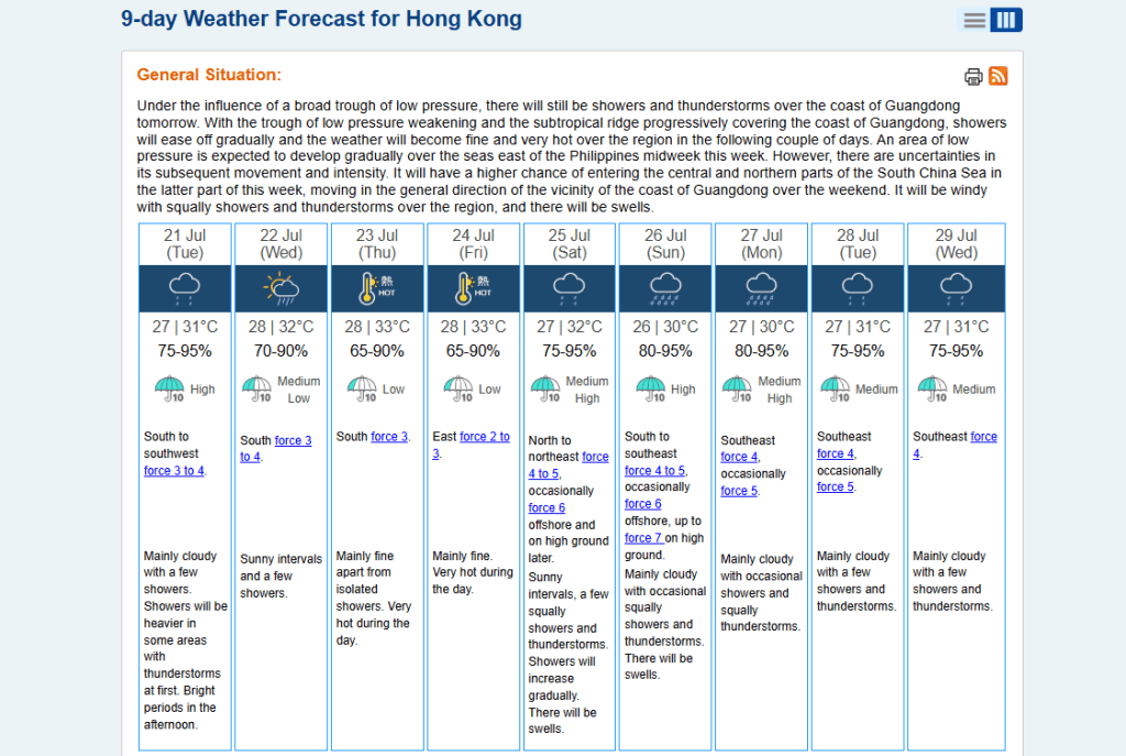
A low-pressure area developing east of the Philippines is expected to enter the northern South China Sea mid-week and head toward the Guangdong coast over the weekend, bringing squally showers and thunderstorms over the region.
The Hong Kong Observatory has upgraded its wind forecast for next Sunday (July 26), predicting that winds on high ground could reach a Force 7 strong breeze.
Artificial intelligence weather forecasting models currently differ on the system’s likely track and intensity.
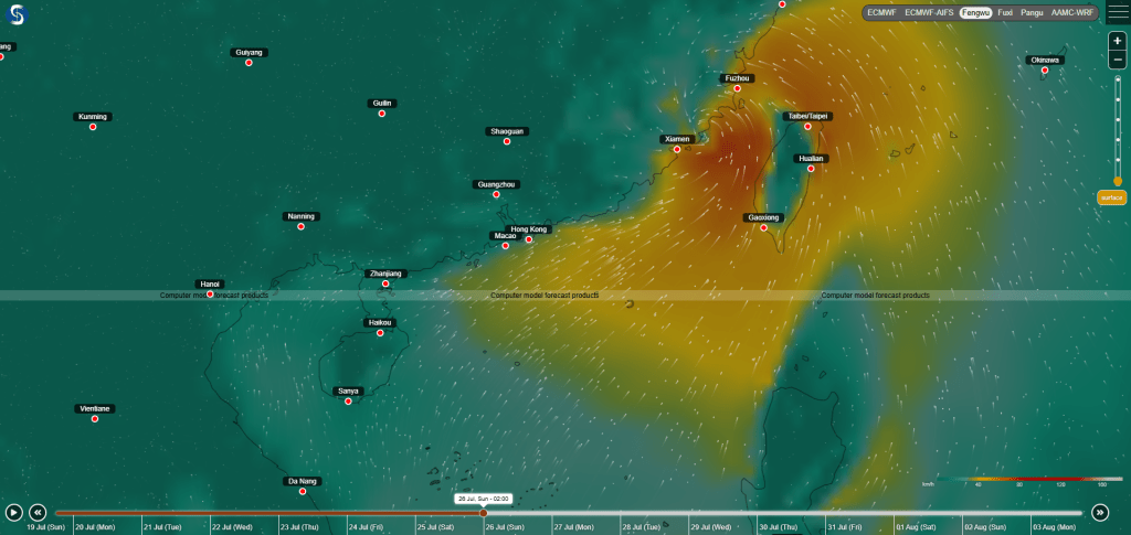
The Fengwu model suggests the system may move northeast toward Xiamen and Fuzhou, rather than approaching Hong Kong directly.
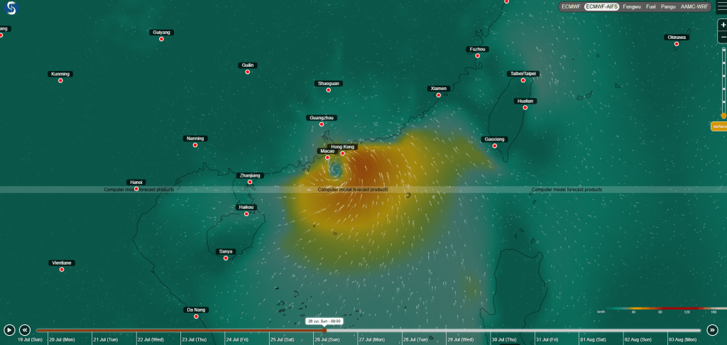
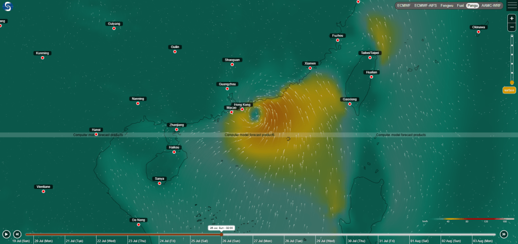
By contrast, the Pangu and ECMWF-AIFS models continue to forecast a direct approach toward the city, with the closest passage expected on Sunday, though it would likely affect a smaller area and bring weaker winds.
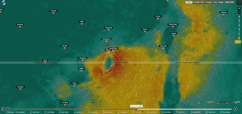
Meanwhile, the European Centre for Medium-Range Weather Forecasts (ECMWF) conventional supercomputer predicts a broader and stronger system that also tracks toward Hong Kong, but projects a later arrival on next Tuesday (July 28).
In the near term, a broad trough of low pressure will continue to bring showers and thunderstorms to the Guangdong coast on Tuesday.
As the trough weakens and a subtropical ridge gradually takes over, showers are expected to ease over the next few days.
Wednesday will bring a few lingering showers alongside sunny intervals during the day.
Conditions will then become fine and extremely hot over the following couple of days, before weather conditions turn unstable again over the weekend.