Read More


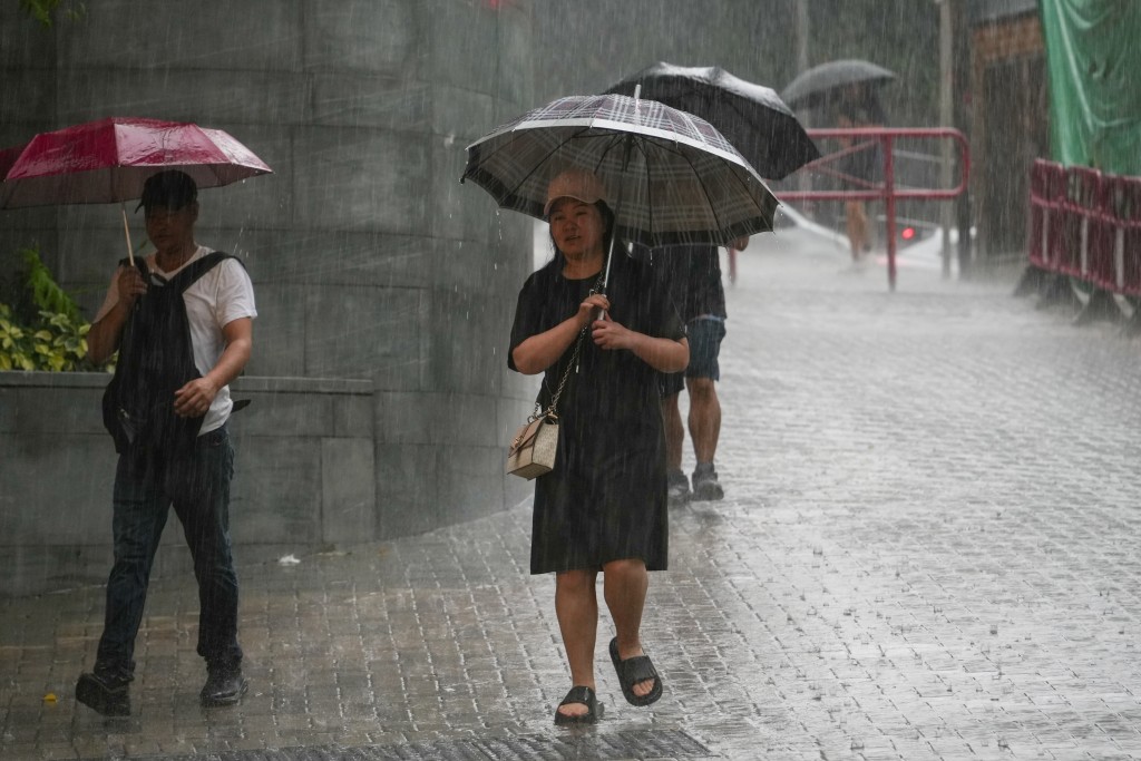
The Hong Kong Observatory warned on Tuesday (May 19) that widespread heavy rain could affect many parts of Hong Kong within the next one to two hours, as rainbands move northwards across the territory.
In a special weather advisory issued at 11.45am, the observatory said another thunderstorm band south of Hong Kong was approaching the city and was expected to bring heavier showers around midday.
The forecaster said around 10 millimeters of rainfall had been recorded in many areas over the past two to three hours, while rainfall on Lantau Island exceeded 20 millimeters.
The observatory said the easterly airstream affecting the Guangdong coast was gradually being replaced by southerly winds, contributing to unstable weather conditions in the region.
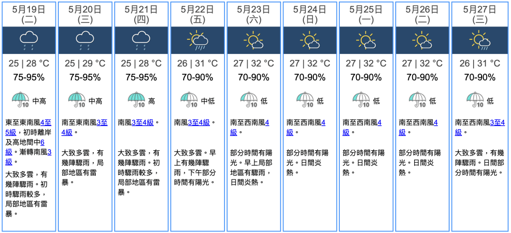
Hong Kong is expected to remain mainly cloudy on Tuesday, with occasional showers and isolated thunderstorms. Temperatures are forecast to reach about 28 degrees Celsius.
Moderate to fresh easterly to southeasterly winds are expected initially, with strong winds offshore and on high ground before gradually turning southerly later in the day.
The observatory said unsettled weather would persist over the next one to two days due to an upper-air disturbance affecting southern China.
Showers are expected to ease gradually from Friday (May 22), and over the weekend as an anticyclone strengthens over the northern part of the South China Sea, bringing brighter and persistently hot weather to the coast of southern China.
Temperatures are forecast to rise to around 30°C on Friday, followed by a spell of up to 32°C from Saturday (May 23) lasting about four consecutive days.
The Observatory issued an Amber Rainstorm Warning Signal at 12.35pm.