Read More


Night Recap - May 21, 2026
9 hours ago


ImmD crackdown targets moonlighting domestic helpers arresting 17
19-05-2026 17:52 HKT

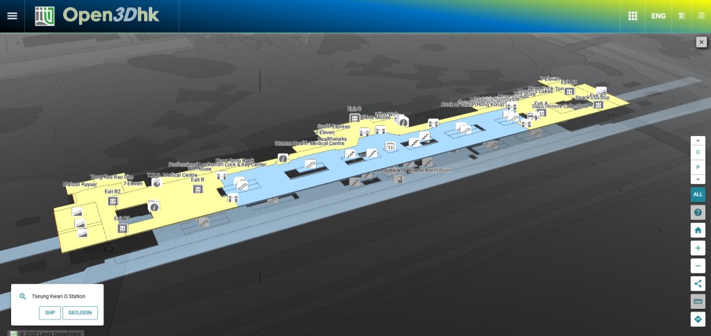
Navigating Hong Kong’s bustling MTR network just got easier, as the Lands Department announced on Thursday the expansion of its 3D Indoor Map and Indoor Network to include all 98 MTR stations across the city’s 10 rail lines.
This upgrade promises to enhance the travel experience for commuters and visitors by offering detailed, interactive spatial data for seamless station navigation.
Initially launched in March with 3D maps for 30 selected MTR stations, the initiative—developed in partnership with MTR Corporation Limited—has now been extended to cover the entire network, including lines like the Airport Express, East Rail, and Island Line.
The 3D Indoor Map provides a vivid digital layout of publicly accessible areas within stations, detailing levels, shops, facilities, and key points of interest.
Paired with the 3D Indoor Network, it connects various station elements like entrances, exits, and shops, enabling users to plan point-to-point routes with ease. The system also highlights barrier-free paths, ensuring accessibility for all.
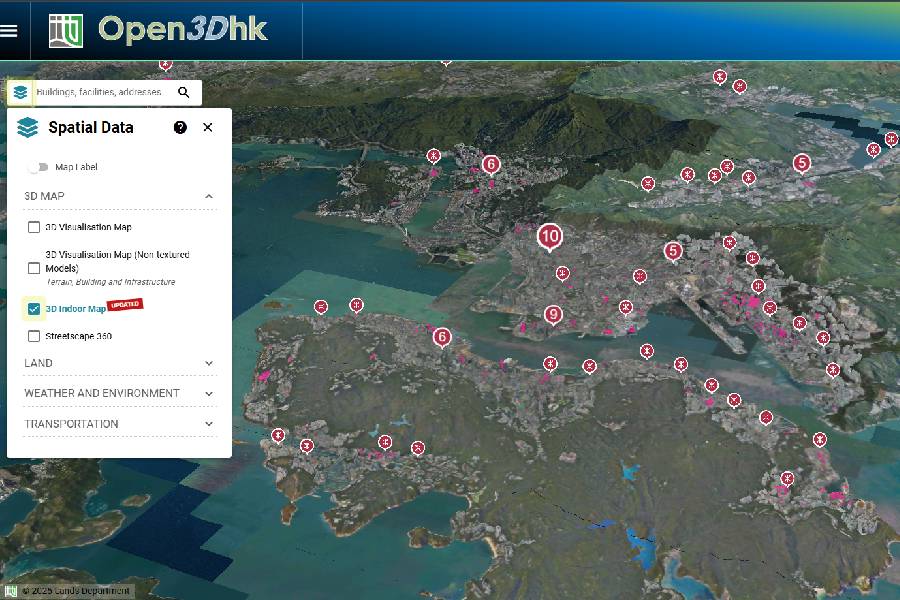
Available for free on the Common Spatial Data Infrastructure (CSDI) Portal, the dataset is accessible to the public and developers alike.
The portal offers Application Programming Interfaces (APIs) and sample codes to support app development, while the “Open3Dhk” platform allows users to explore the maps and plan routes online.
In addition, the Lands Department recently introduced a territory-wide 3D Visualisation Map in late September, featuring over 220,000 geometric models of buildings and infrastructure.
This dataset, also freely available on the CSDI Portal, further enriches Hong Kong’s digital mapping resources.
With these advancements, the city is enhancing its infrastructure to make travel and urban exploration more intuitive and inclusive for everyone.