
Read More


Morning Recap - July 3, 2026
7 hours ago


John Lee thanks wife for unwavering support after four years in office
01-07-2026 13:21 HKT
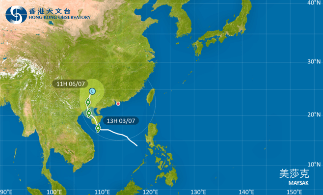
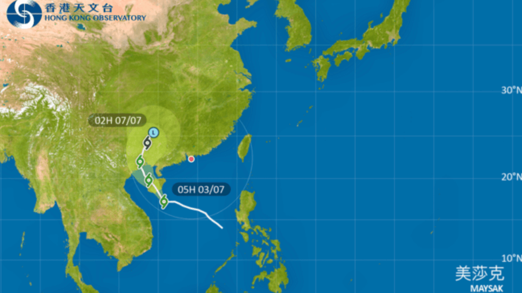
The Standby Signal No. 1 will remain in force until at least 6pm on Friday, as Tropical Storm Maysak gradually moves closer to Hainan Island while still keeping a considerable distance from Hong Kong.
The Hong Kong Observatory said it would assess whether to issue the Strong Wind Signal No. 3 later in the day, depending on changes in Maysak’s intensity, the distance between its strong wind zone and the Pearl River Estuary, and local wind conditions.
At 2pm, Maysak was estimated to be about 690 kilometers southwest of Hong Kong and was forecast to move northwest at about 10 kilometers per hour in the general direction of Hainan Island.
The Observatory said the outer rainbands associated with Maysak were bringing squally showers and violent gusts to areas near the Pearl River Estuary.
Under the combined effect of Maysak and a ridge of high pressure gradually establishing over southeastern China, local offshore winds were occasionally strong, while winds over some high ground reached gale force due to terrain effects.
There will also be swells, and members of the public are advised to stay away from the shoreline and avoid water sports.
Separately, the Observatory issued a special weather tip at 1.45pm, warning that a band of intense thundery showers over waters south of Hong Kong was gradually edging closer.
Heavy rain may affect widespread areas of Hong Kong in the next couple of hours, along with severe squally thunderstorms. Members of the public are advised to stay alert and keep track of the latest weather information.