
Read More
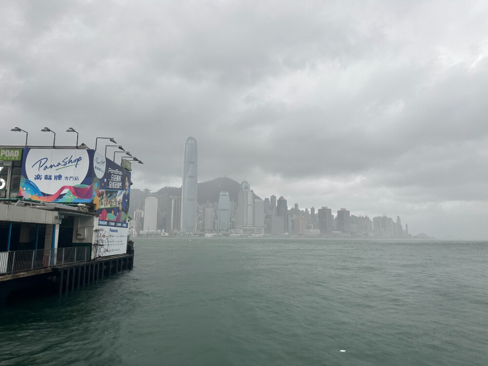
Hong Kong experienced its hottest day of the year so far on Friday, breaking historical temperature records for the traditional "Mangzhong" solar term. However, the extreme heat is rapidly giving way to severe weather, with the Hong Kong Observatory (HKO) warning of potential hail, squally thunderstorms, and a continuous nine-day stretch of rain expected to drench the city starting this weekend.
ADVERTISEMENT
SCROLL TO CONTINUE WITH CONTENT
Sizzling temperatures and hail alerts
The Observatory recorded a maximum temperature of 34.6 degrees Celsius on Friday afternoon, marking the highest temperature of the year and the hottest "Mangzhong" or "Grain in Ear" solar term ever documented in the city.
The heat was even more severe in the New Territories, with the mercury soaring to a staggering 36.9 degrees Celsius in Sheung Shui.
In response to the sweltering conditions, authorities issued a Very Hot Weather Warning early in the morning.
However, the intense regional heat quickly triggered atmospheric instability along the coast of Guangdong.
By 5.15pm, the Observatory issued a special weather tip warning residents that Hong Kong could be affected by hail within a short period.
Heat stress and incoming squalls
The extreme temperatures earlier in the day prompted the Labour Department to issue an Amber Heat Stress at Work Warning at noon, indicating high heat stress levels for outdoor and physically demanding working environments.
As the afternoon progressed, the focus shifted entirely from extreme heat to severe weather preparations.
At 5.45pm, the Observatory released another urgent alert noting that heavy showers and intense squally thunderstorms were actively affecting the Pearl River Estuary.
Meteorologists cautioned that parts of Hong Kong would experience significantly heavy rainfall over the following hour or two.
Extended wet weather on the horizon
Relief from the scorching temperatures will arrive in the form of a prolonged period of wet weather.
Forecasters predict that a broad trough of low pressure will linger over the coast of southern China and the northern part of the South China Sea from Saturday through the middle of next week.
This active weather system will bring nine consecutive days of rain, which will help alleviate the intense heat.
Heavy showers and severe squally thunderstorms are expected to peak on Sunday and Monday, bringing temperatures down to a cooler range of 26 to 30 degrees Celsius.
The unsettled, cloudy weather and localized thunderstorms will persist into Tuesday and Wednesday.
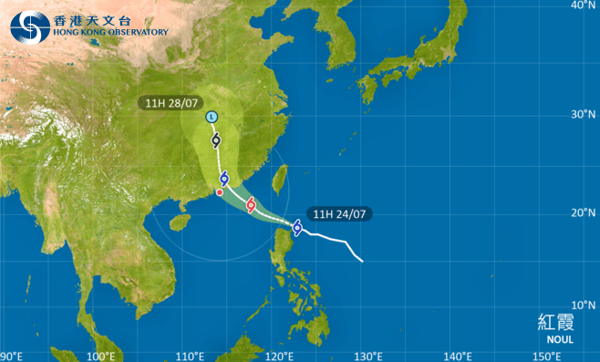
Meanwhile, regional meteorologists are also tracking a tropical depression near Taiwan, which was located just east-northeast of Kaohsiung at midday and is projected to move steadily northeast across the southern part of the island.