Read More


HK movie producer Raymond Wong Pak-ming convicted of insider dealing
22-05-2026 17:10 HKT
Swire Properties wins compulsory auction for $2.02b Quarry Bay property
22-05-2026 20:36 HKT


Hong Kong is bracing for potentially more turbulent weather as its record-breaking typhoon season continues, with forecasts suggesting new tropical cyclones could form soon after Typhoon Matmo swept past the city.
The storm, which passed 330 kilometers southwest of Hong Kong before the Mid-Autumn Festival, marked the 12th tropical cyclone to affect the city this year, surpassing a record set in 1946 for the most typhoon signals raised in a single year.
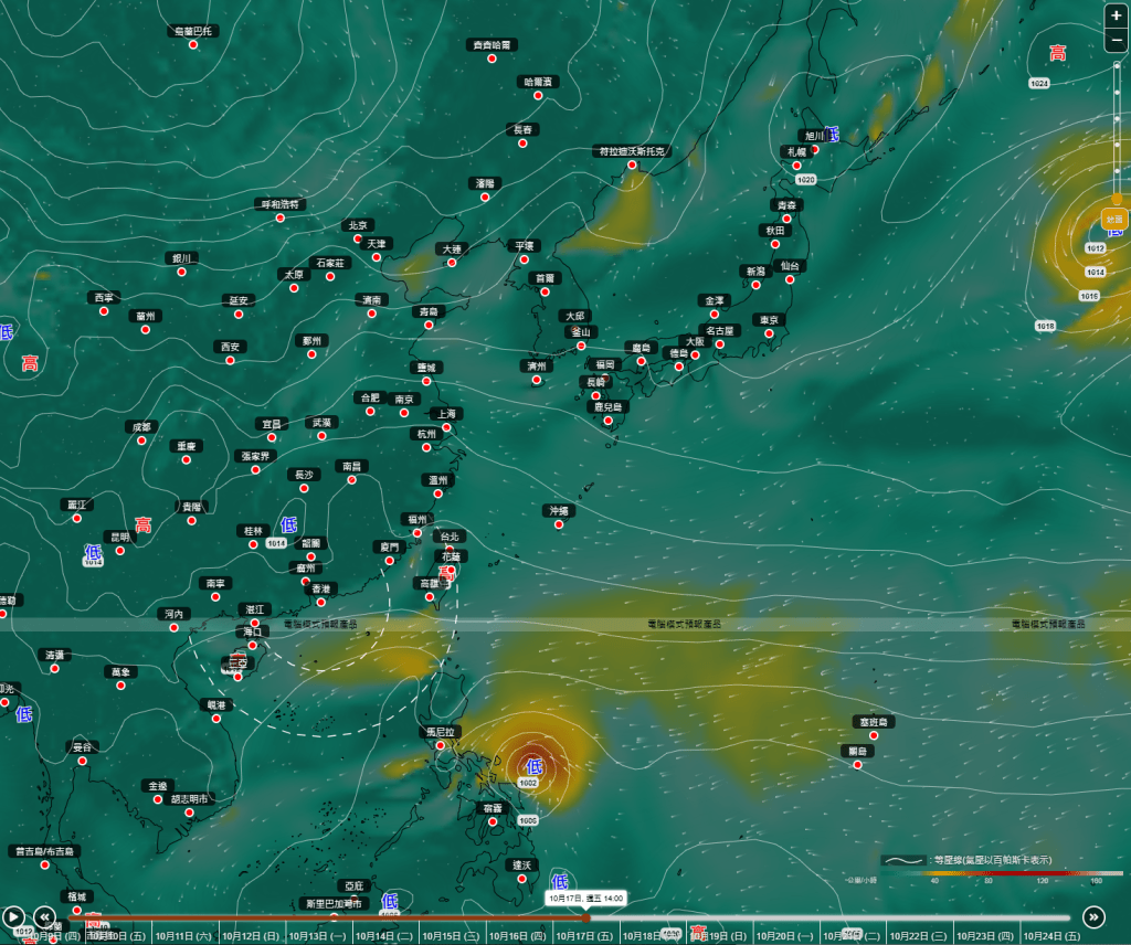
The Hong Kong Observatory’s AI-driven model, dubbed “Fengwu Model,” predicts that a new tropical cyclone may form east of the Philippines by October 17, potentially moving toward the South China Sea and entering Hong Kong’s 800-kilometer radius by October 19 before heading west toward Hainan Island.
Meanwhile, the mainland's Central Meteorological Observatory has flagged the possibility of another tropical depression or typhoon forming in the South China Sea or western Pacific.
These developments suggest the city’s unprecedented typhoon activity may not be over yet.
Adding to the weather outlook, a high-altitude anticyclone currently over southern China is expected to weaken starting tomorrow, bringing occasional showers to Guangdong’s coast.
Early next week, a broad low-pressure trough could usher in showers and thunderstorms to northern parts of the South China Sea and Guangdong. However, clearer skies are anticipated by mid-to-late next week as the anticyclone strengthens.
Elsewhere, Tropical Storm Nakri, located 450 kilometers east of Okinawa at noon today, is expected to move northwest across the seas south of Japan over the next couple of days.