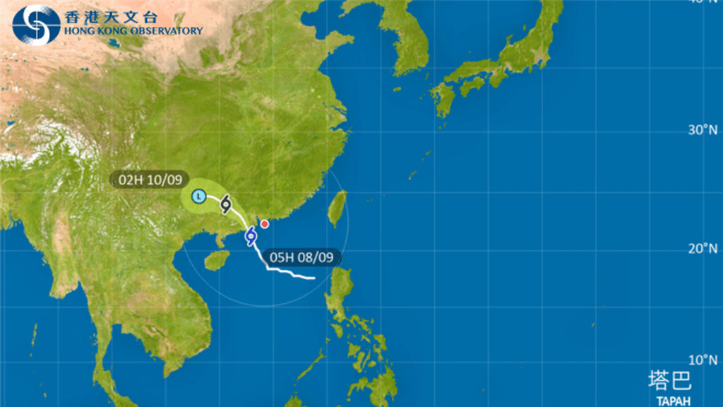
The Hong Kong Observatory has issued the Amber Rainstorm Warning Signal while maintaining the No. 8 Gale or Storm Signal until at least 11am Monday as Typhoon Tapah passes about 170 kilometers southwest of Hong Kong.
At 4.55am, the observatory issued the Amber Rainstorm Warning, indicating heavy rain exceeding 30 millimeters per hour has fallen or is expected across Hong Kong. The warning advises potential flooding in low-lying and poorly drained areas, urging affected residents to take precautions.
Gale force winds are affecting offshore areas with storm force winds on high ground. Tapah is expected to make landfall over western Guangdong within hours, with its rainbands continuing to bring heavy squally showers to the Pearl River Estuary.
Very rough seas with swells are reported, and the public is advised to avoid shorelines and water activities. Combined spring tide and storm surge effects are raising water levels along western Hong Kong coasts higher than normal, potentially causing flooding in low-lying areas.
Maximum sustained winds in the past hour reached 97 km/h at Ngong Ping, 80 km/h at Cheung Chau and 68 km/h at Waglan Island, with maximum gusts exceeding 125, 103 and 86 km/h respectively.