Read More


Xiaomi CEO Lei Jun takes selfie with Musk goes viral online
14-05-2026 23:39 HKT

Hong Kong: a familiar, trusted partner for Australian businesses
11-05-2026 06:00 HKT
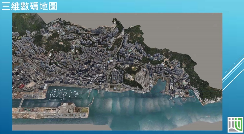
Some 122,000 buildings and 3,300 infrastructure facilities, including flyovers, footbridges and subways in Hong Kong Island, New Territories Southwest and New Territories East, have been covered in the Lands Department’s newly expanded 3D Visualization Map.
The latest update completes the phased rollout of the 3D Digital Maps initiative, which began in 2022, achieving full geographic coverage of Hong Kong.
The map features a "Streetscape 360" function, offering 360-degree street-level panoramic images and measurement tools, which has been extended from Kowloon, Lantau and New Territories Northwest to now include Hong Kong Island and the entire New Territories.
A territory-wide 3D Indoor Map now also covers around 30 MTR stations, providing details on points of interest and an indoor point-to-point pedestrian routing service for navigation within stations.
Combined with last year’s release of 3D Indoor Maps for Kowloon East, Kowloon Central and Kowloon West—which included about 200 buildings—the territory-wide indoor mapping system now encompasses 600 buildings, spanning government offices, private complexes, community facilities, and hospitals.
The department said the data supports smart city development, enabling innovations such as location-based services, tourism apps and indoor navigation systems.
All datasets, along with application programming interfaces (APIs) and sample codes, are available for free download on the Common Spatial Data Infrastructure Portal (portal.csdi.gov.hk) and the Open3Dhk platform (3d.map.gov.hk).
(Ayra Wang)
")