Read More


Amber rainstorm warning issued at 11am
8 hours ago


Iran demands transit fees in yuan, stablecoins for Strait of Hormuz passage
03-04-2026 02:45 HKT
The recent discovery of a World War II-era bomb in Quarry Bay has sparked renewed interest in Hong Kong’s wartime history, prompting Hong Kong Baptist University (HKBU) to launch a unique exhibition showcasing nearly 100 rare aerial photographs.
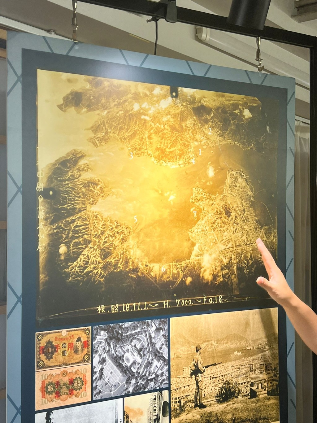
These images, captured by Allied forces during Japan’s occupation of Hong Kong from 1941 to 1945, offer a vivid glimpse into the city’s past, focusing on areas like Sham Shui Po, Kowloon City, and Yau Tsim Mong.
Accompanied by historical building models and literary works, the exhibition reconstructs the urban landscape of wartime Hong Kong, shedding light on a pivotal chapter in the city’s history.
Organized by HKBU’s History Department as part of its Hong Kong Spatial History Project, the exhibition displays photographs sourced from archives in the United States and Japan.
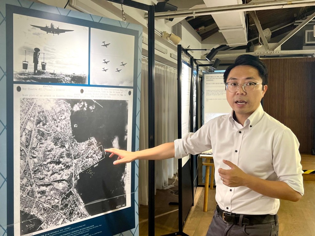
These images, taken during reconnaissance missions to assess the impact of Allied air raids on Japanese military operations, reveal Hong Kong’s strategic importance as a Japanese naval base during the war.
The bomb found in Quarry Bay, safely defused earlier this year, is believed to be a relic of those Allied efforts to disrupt Japanese supply lines.
The photographs, previously unreleased to the public, were uncovered by the HKBU team in 2023 with guidance from an American professor researching North Korean architecture, who shared expertise on accessing wartime imagery.
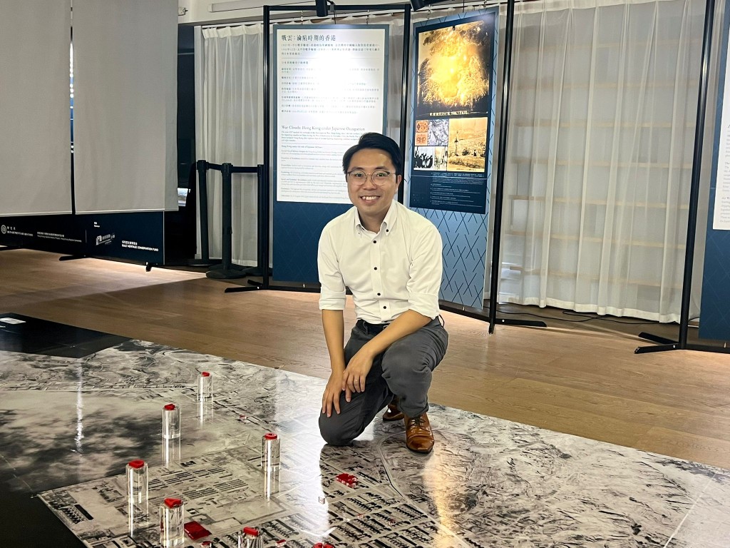
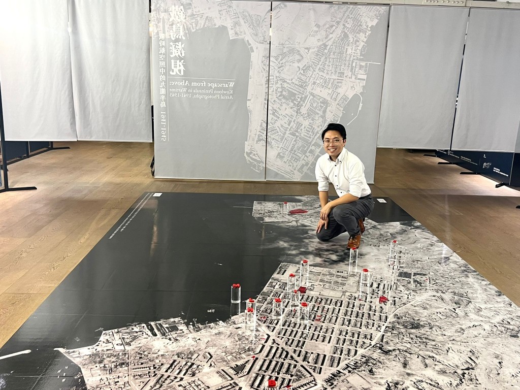
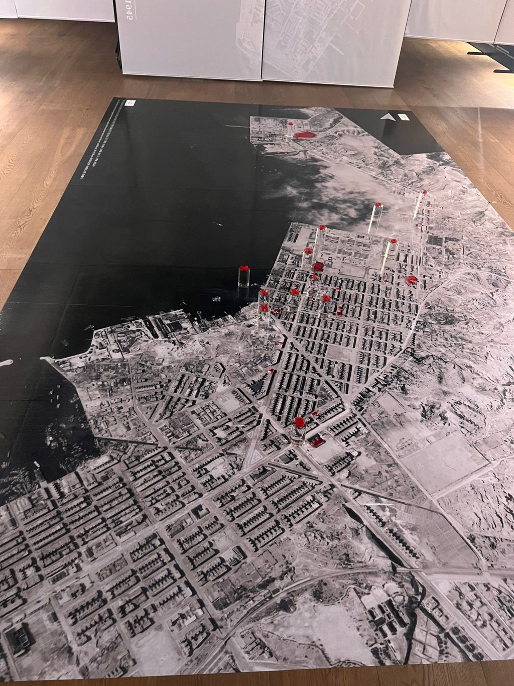
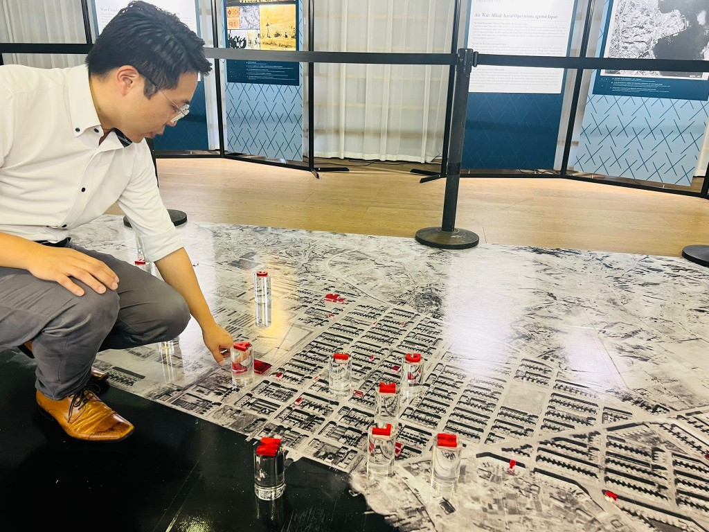
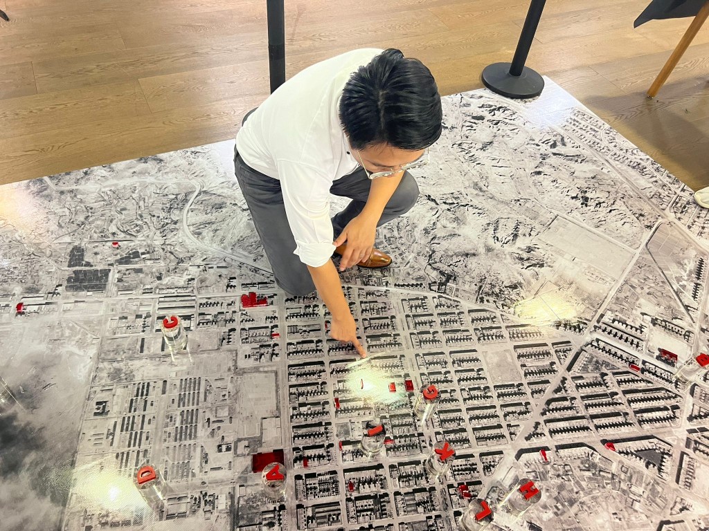
Running from September 25 to December 10 across three venues, the exhibition features a large-scale map of Kowloon, created from enlarged aerial photos that allow visitors to explore the city’s wartime appearance in detail.
The images, often captured at noon to avoid cloud cover, reveal intricate details such as the rooftops of the North River Street Market in Sham Shui Po, pedestrians on the streets, and roads left empty after nearby oil depots were bombed.
These photographs fill critical gaps in Hong Kong’s historical record, offering insights into the city’s transformation from the pre-war to post-war era, including changes to areas like Kai Tak, where buildings were either destroyed by air raids or later rebuilt.
To enhance the experience, the HKBU team collaborated with the university’s CHRYSALIS art-technology incubator and a creative consultancy to produce three-dimensional models of wartime structures, such as Ho Tung Technical School, Lui Seng Chun, and Nam Cheong Pawn Shop.
These models, based on the aerial photographs, allow visitors to examine the buildings’ original designs from multiple angles. Additionally, HKBU partnered with the Hong Kong Polytechnic University to use LiDAR scanning technology to locate military relics, enriching the exhibition’s historical narrative.
The project’s lead, a professor and head of HKBU’s History Department Kwong Chi-man, noted that analyzing the vast collection of photographs was a labor-intensive process, requiring significant effort to interpret the visual data.
The result, however, is a powerful testament to the value of these images, which not only served military purposes during the war but now provide an invaluable resource for understanding Hong Kong’s urban evolution.
The exhibition invites the public to explore this visual archive, offering a rare opportunity to connect with the city’s wartime past and its enduring legacy.