Read More


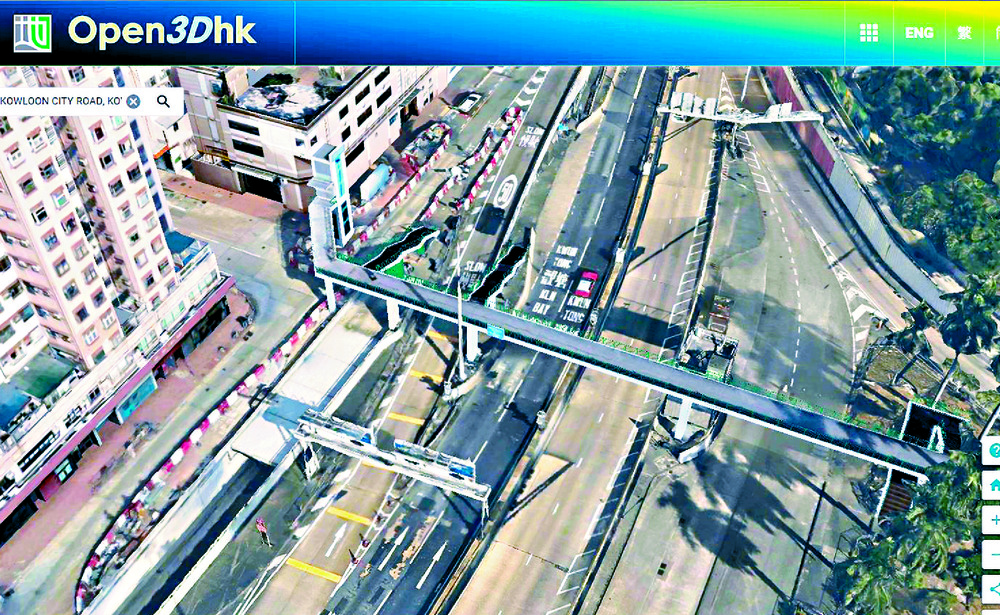
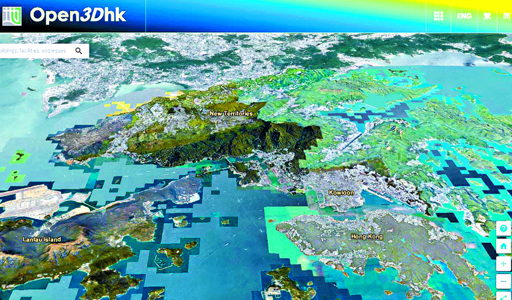
Some 122,000 buildings and 3,300 infrastructure facilities, including flyovers, footbridges and subways in Hong Kong Island, New Territories Southwest and New Territories East, have been covered in the Lands Department's newly expanded 3D Visualization Map.
The map features a "Streetscape 360" function - offering 360-degree street-level panoramic images and measurement tools - which has been extended from Kowloon, Lantau and New Territories Northwest to now include Hong Kong Island and the entire New Territories.
Combined with last year's release of 3D Indoor Maps for Kowloon East, Kowloon Central and Kowloon West - which included about 200 buildings - the territory-wide indoor mapping system now encompasses 600 buildings, spanning government offices, private complexes, community facilities, and hospitals.
The department said the data supports smart city development, enabling innovations such as location-based services, tourism apps and indoor navigation systems.All datasets, along with application programming interfaces and sample codes, are available to download for free on the Common Spatial Data Infrastructure Portal at portal.csdi.gov.hk and the Open3Dhk platform at 3d.map.gov.hk.
ayra.wang@singtaonewscorp.com