Read More


Night Recap - May 26, 2026
8 hours ago


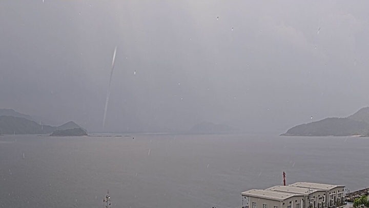
The Hong Kong Observatory has clarified that a viral image appearing to show a waterspout off the coast of Sai Kung on Monday morning was most likely just a raindrop captured up close by the camera lens.
This came after a photo taken by an Observatory camera near the Sai Kung Marine East Division during the Amber Rainstorm Warning had sparked a heated online discussion.
The image appeared to show a waterspout as a towering column of air and water mist connecting the sea surface to the cloud base.
However, the Observatory later stated that the image did not display the characteristic features of a waterspout and that corresponding radar imagery did not support such a formation.
The most probable explanation, according to the forecaster, is that the camera lens captured a close-range raindrop, creating the illusion of a distant column of water.
According to the Observatory's website, a waterspout is a rapidly rotating columnar vortex of water droplets that links the base of a convective cloud to the water's surface.
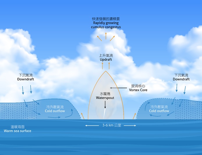
Its wind speed is often lower than that of a tornado that occurs over land. The phenomenon's Chinese name translates to "dragon's siphon," as it can sometimes appear to be a dragon sucking up water from the sea.
In Hong Kong, waterspouts are most commonly seen during the rainy season between May and October. From 1959 to 2017, there were a total of 35 cases of waterspouts sighted in Hong Kong.