Read More

Night Recap - May 22, 2026
8 hours ago


ImmD crackdown targets moonlighting domestic helpers arresting 17
19-05-2026 17:52 HKT

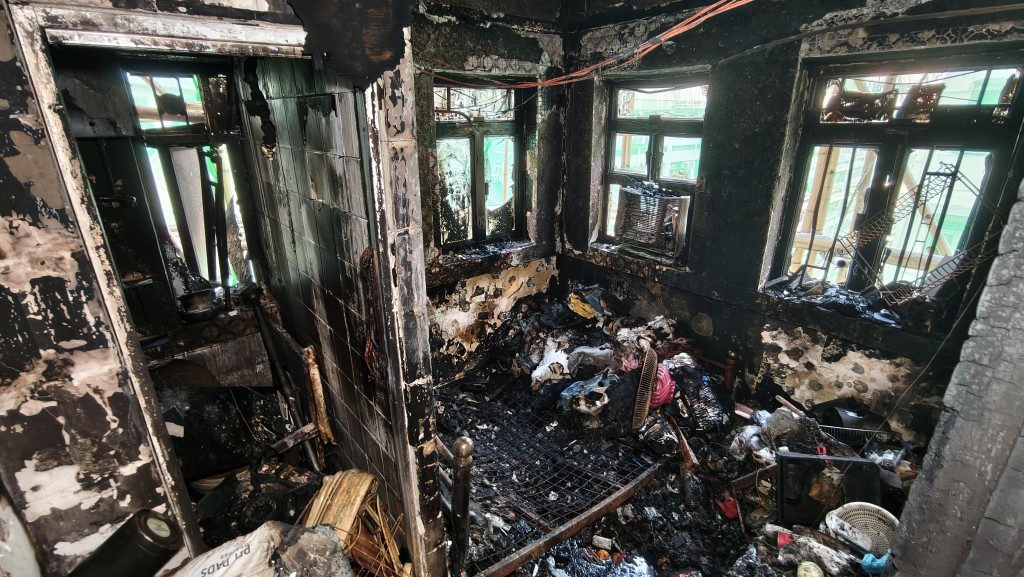
One dead, four injured in Jordan flat fire, 200 residents evacuated
22-05-2026 00:48 HKT
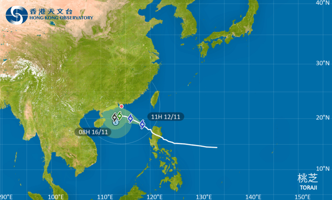
The Hong Kong Observatory said it will consider issuing the Strong Wind Signal, No. 3 during the day on Wednesday as Severe Tropical Storm Toraji gradually moves across the northern part of the South China Sea.
The HKO said in a weather bulletin that the Standby Signal, No. 1 will remain in force at least until midnight.
As Toraji edges closer to the coast of southern China, under its combined effect with the northeast monsoon, winds over the region will strengthen gradually. The Observatory will consider issuing the Strong Wind Signal, No. 3 during the day tomorrow.
“It is expected that Toraji will skirt around 200 kilometers to the south of the territory on Thursday morning. Depending on the intensity of Toraji at that time, the distance of its associated gale winds from the Pearl River Estuary and the change in local wind conditions, the Observatory will assess the need of issuing higher Tropical Cyclone Warning Signals,” the HKO said.
At 10 am, Severe Tropical Storm Toraji was estimated to be about 610 kilometers southeast of Hong Kong and is forecast to move west-northwest at about 15 kilometers per hour across the northern part of the South China Sea.
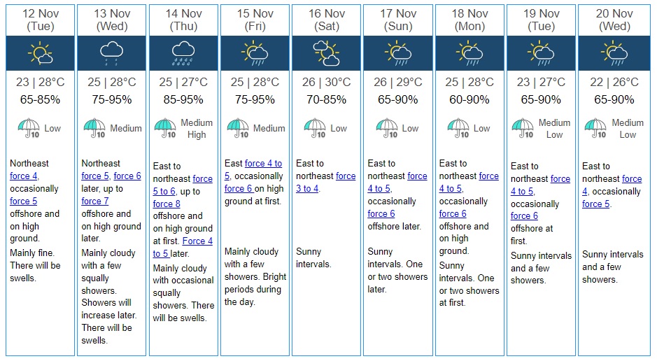
The HKO said winds will strengthen gradually with occasional squally showers in the next couple of days, along with swells.