Read More
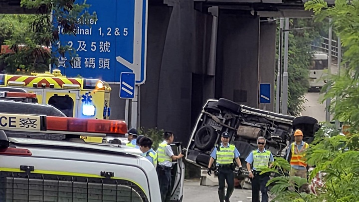
In response to the increased risk of flooding at low-lying road sections during extreme weather, the government announced on Friday that they will initiate a pilot scheme on the wading line system at five high-risk locations.
ADVERTISEMENT
SCROLL TO CONTINUE WITH CONTENT
This initiative aims to monitor flooding in real time, enhance the coordination of government departments, and alert drivers to prevent vehicle damage.
The selected pilot locations are Chai Wan Road, Lung Cheung Road, Tsui Ping Road, Chatham Road North, and Nam Wan Road in Tai Po Market. These areas were notably affected during the severe rainstorms of September 2023, which led to significant vehicle damage and operational disruptions.
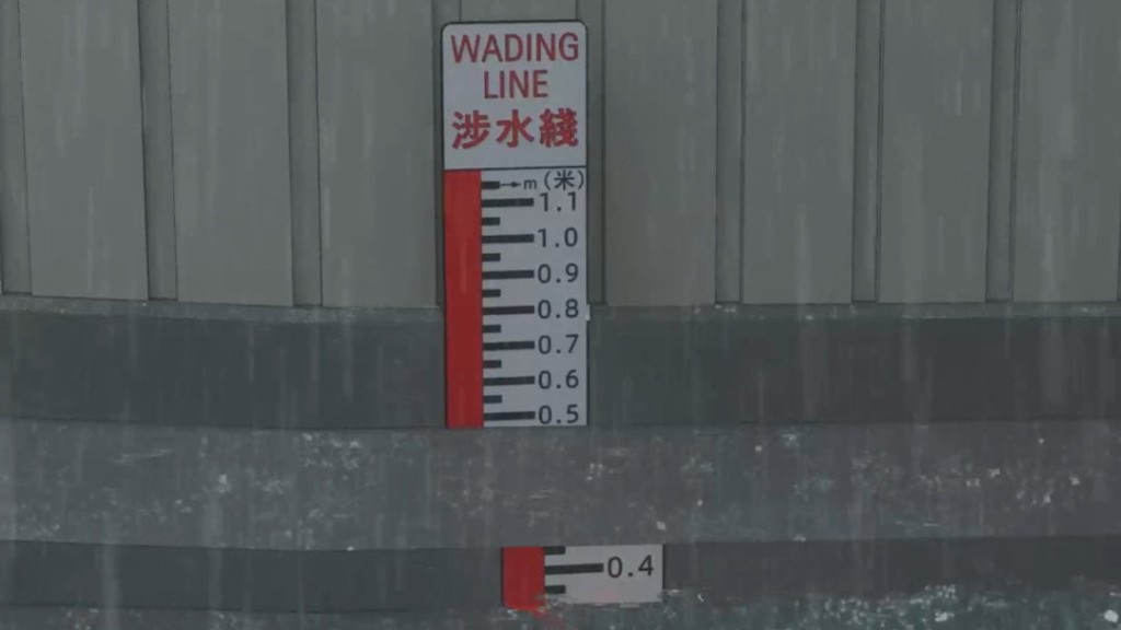
The scheme will feature red wavy "Wading Line" markings on the road surface, accompanied by a water meter gauge and a nearby sign. When water levels reach or exceed 0.3 meters at the lowest point of the road, the system will indicate potential flooding ahead.
To support this, the Drainage Services Department (DSD) will install flood monitoring devices to gather real-time water level data. Upon detecting critical water levels, the system will alert the relevant departments.
The DSD and the Highways Department (HyD) will then coordinate emergency teams to address and mitigate flooding risks, including clearing blocked drains. Additionally, temporary traffic guidance will be implemented to prevent vehicles from entering flooded areas, with the Transport Department providing traffic updates and police assistance as needed.
Drivers caught in rising water levels should stop before the wading line, turn on hazard lights, and adhere to on-site directions to exit the area safely.
The government will closely monitor the scheme's effectiveness and make necessary adjustments. Installation of the system will commence in late April by the HyD, with expected completion by mid-May. Temporary traffic arrangements will be phased in during this period to facilitate smooth implementation.