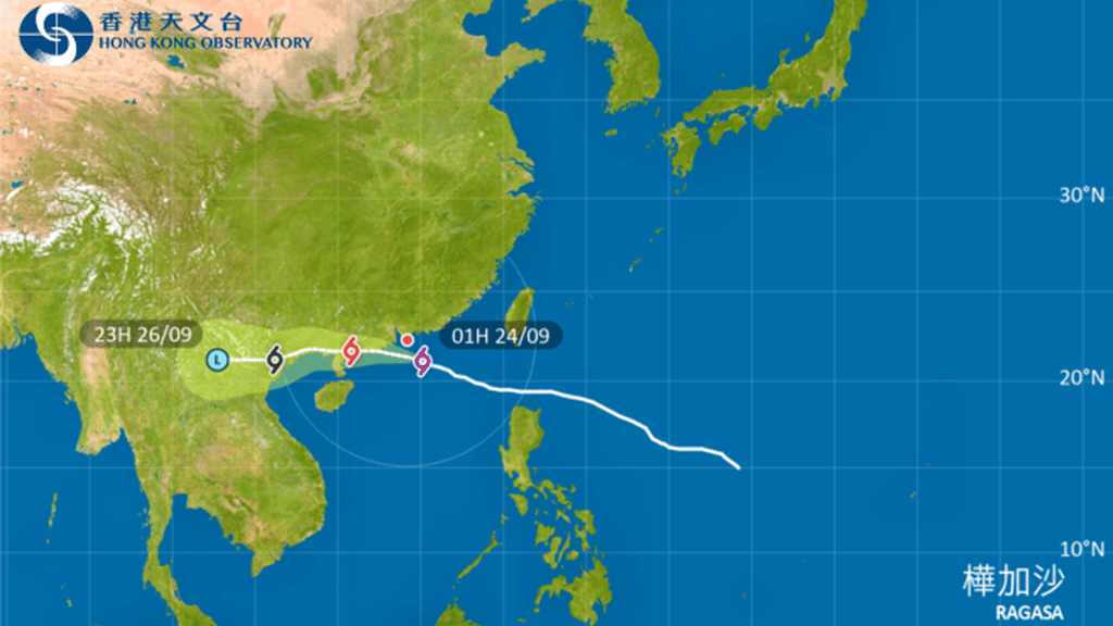
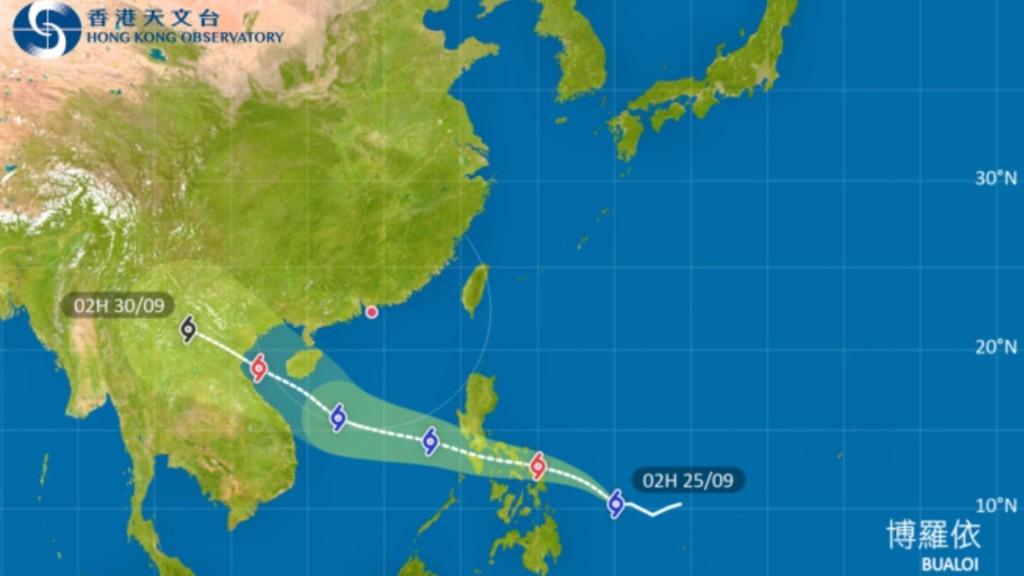
The Hong Kong Observatory hoisted the Increasing Gale or Storm Signal No. 9 at 1:40am as Super Typhoon Ragasa moves closer to Hong Kong, with winds expected to intensify significantly.
At 2am, Super Typhoon Ragasa was centered about 150 kilometers south-southeast of Hong Kong near latitude 21.1 degrees north and longitude 114.9 degrees east, moving west-northwest at approximately 22 kilometers per hour toward the Pearl River Estuary and western Guangdong coast.
Gale force winds are currently affecting many areas locally, with some locations experiencing storm force conditions. Ragasa is forecast to be closest to Hong Kong this morning, passing about 100 kilometers south of the territory. As the hurricane-force winds gradually approach, local winds will continue strengthening. The Observatory will assess whether to issue the Hurricane Signal No. 10 based on changing wind conditions.
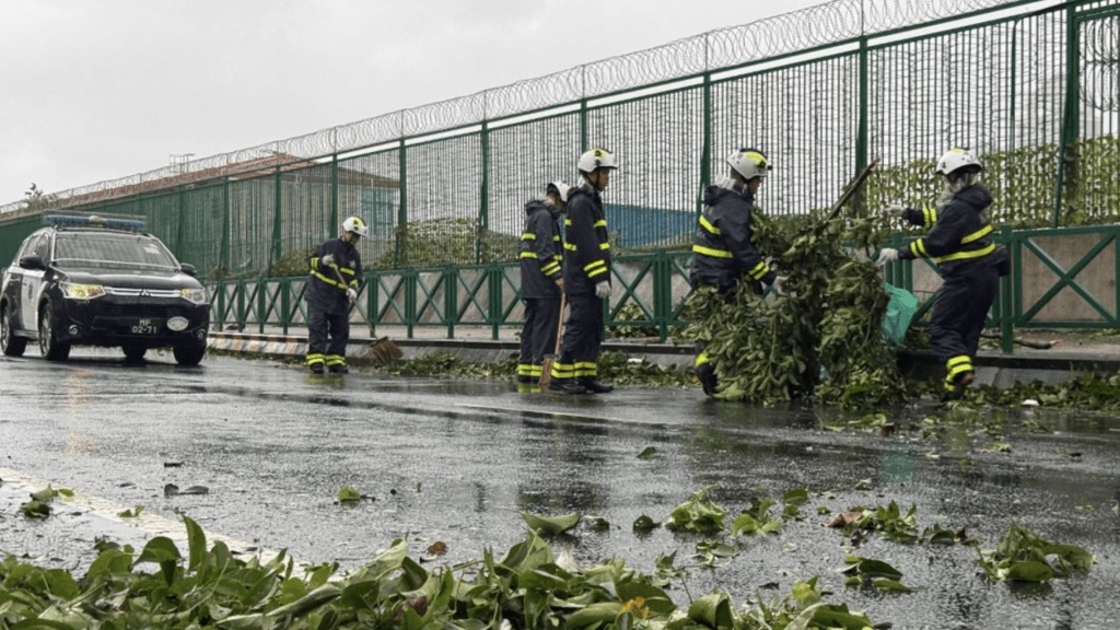
Local winds will gradually shift from northerlies to east-southeasterlies this morning, potentially exposing previously sheltered areas. Weather conditions will remain persistently adverse with frequent heavy squally showers and thunderstorms. Seas will be phenomenal with swells, and significant wave overtopping is expected along eastern and southern coastlines.
A storm surge of approximately 2 meters is anticipated, with water levels beginning to rise around 6am and peaking late morning to early afternoon at 3.5 to 4 meters above chart datum generally, and 4 to 5 meters in Tolo Harbour.
Maximum sustained winds recorded in the past hour reached 100 km/h at Waglan Island, 99 km/h at Tate's Cairn and 76 km/h at Cheung Chau, with maximum gusts exceeding 120, 132 and 101 km/h respectively.