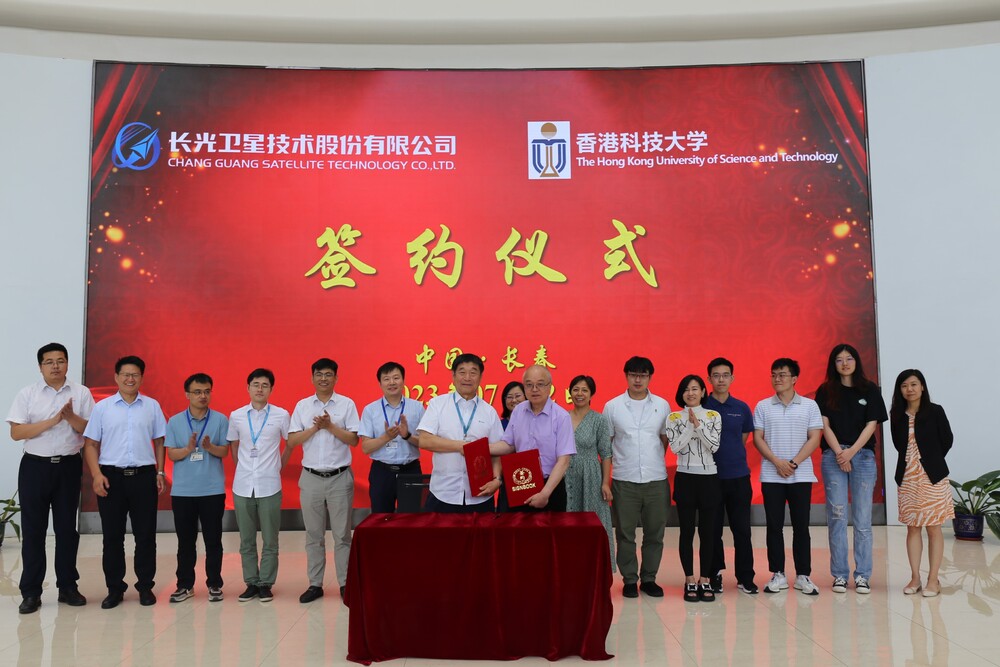
University of Science and Technology is set to become the first local university to launch a satellite when it sends up a mission in cooperation with a mainland technology company on Friday.
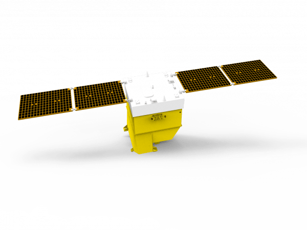
Optical satellite HKUST-FYBB#1 from Chang Guang Satellite Technology Co will be launched at the Jiuquan Satellite Center in Gansu. It will be used for tracking remote sensing data related to global environment, disasters and sustainable development.
The launch also marks HKUST's first step toward building a remote sensing satellite constellation and a comprehensive environmental monitoring and disaster forecasting system.
Chang Guang, the first commercial remote sensing satellite company in the mainland, has already launched 108 orbiting satellites, which form JiLin-1, the world's largest sub-meter level commercial remote sensing satellite constellation.
The HKUST satellite was named after donors Francis Yip Chi-hung and his wife Catherine Yip Ng Bun-bun.
The university said the satellite is the most advanced civilian type, with spatial resolution of the remote sensing images it collects at 0.5 meters.
That is 20 times higher than the openly accessible data of images taken from the European Space Agency's Sentinel-2 optical satellite.
The satellite's swath of images is more than 150 kilometers, comparable to those of the latest generation of the US land satellites.
HKUST hopes the system can enhance the city's coordination and decision-making in disaster response and management.
The satellite will be used to establish a digital twin system that covers all slopes in Hong Kong for the monitoring of their surface conditions, simulating and showing the process of landslide disasters, and showing responses to emergencies.
It will also help build an environmental monitoring and disaster forecasting system, which provides scientific data to help achieve China's carbon policy goals of peaking carbon emissions by 2030 and achieving carbon neutrality by 2060.
HKUST will enhance the country's remote sensing technology by collecting electromagnetic radiation information from space or higher altitude on Earth's surface. Future efforts will include satellite research and development for carbon emission and its data application.
HKUST Council chair Harry Shum Heung-yeung said: "We look forward to cooperation with the government, research institutes, enterprises and different sectors for wider application of the data we will obtain through our cooperation with Chang Guang."
Wang Yang, vice president for institutional advancement, said: "Our aim is to develop cutting-edge, multimodal spatial remote sensing technologies, including novel carbon monitoring techniques and data analysis tools."
lorraine.chiang@singtaonewscorp.com
HKUST and tech company Chang Guang will launch the satellite on Friday.