Read More

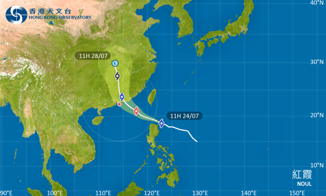
Potential Tropical Storm Noul may pass within 300km of HK this Sun
23-07-2026 13:58 HKT
Typhoon Bavi batters eastern China, threatens days of heavy rain
12-07-2026 14:51 HKT


Japan braces for double storms, torrential rains shut down parts of Taiwan
26-06-2026 10:56 HKT


Shell sued in UK over 2021 Philippines typhoon: NGOs
11-12-2025 10:00 HKT

Tropical cyclone may form near HK later this week
23-11-2025 18:33 HKT

Weakening Typhoon Fung-wong exits Philippines after displacing 1.4 million
10-11-2025 12:45 HKT
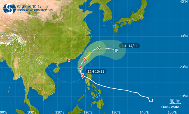
T1 signal remain in force before noon on Tue as Typhoon Fung-wong nears
10-11-2025 11:37 HKT

HKO to issue T1 signal at 8.40pm as Noul approaches
24-07-2026 12:27 HKT