While Typhoon Kalmaegi is expected to bypass Hong Kong, a potential tropical cyclone, Fung-wong, might crash the party, bringing increased rainfall to the city next week.
According to the Observatory, Kalmaegi is currently moving across the South China Sea towards the vicinity of central Vietnam over the next couple of days.
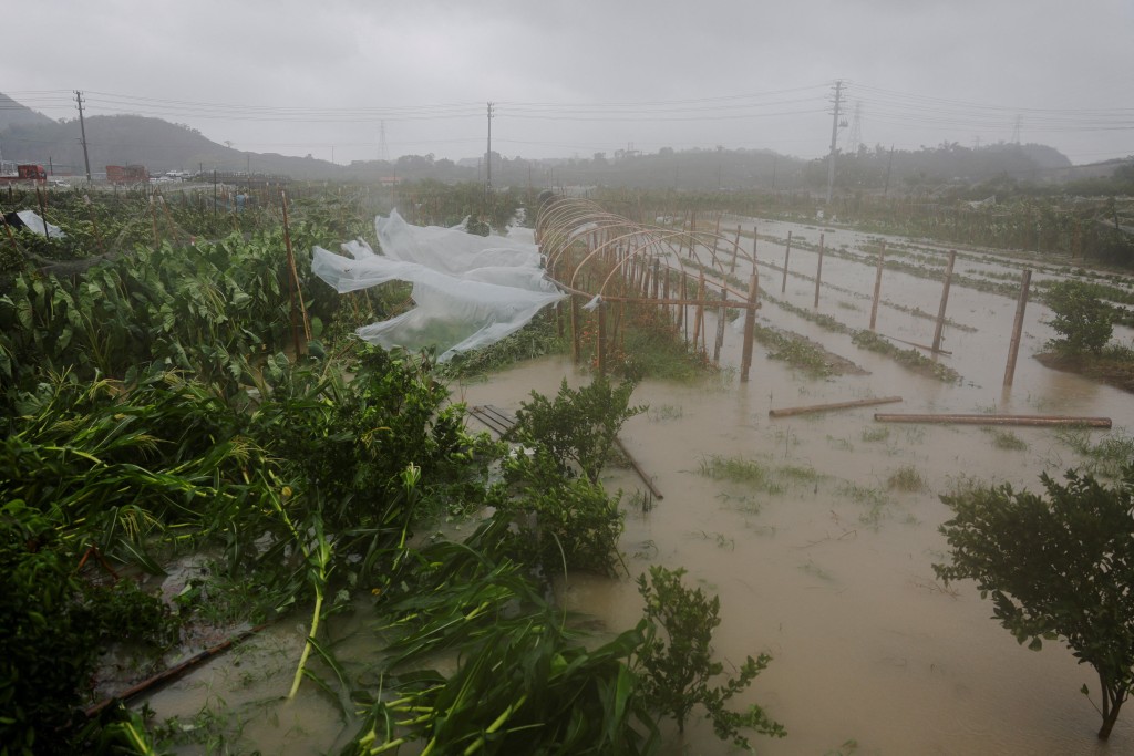
Additionally, a replenishment of the monsoon is expected to impact the coast of Guangdong by the weekend, bringing strong winds and slightly elevated water levels.
With the spring tide occurring from Thursday (Nov 6) to Saturday (Nov 8), low-lying coastal areas may experience minor flooding during the evening.
Typhoon Fung-wong tentatively approaches
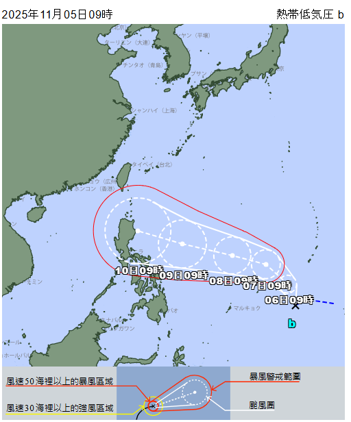
Notably, the forecaster's latest weather report indicated another tropical depression in the south of Guam might gradually intensify into Tropical Storm Fung-wong.
The system is predicted to generally move towards the vicinity of Luzon in the next few days, with a high chance of entering the northeastern part of the South China Sea.
Under the combined effects of the northeast monsoon and the outer circulation of the typhoon, increased rainfall is anticipated in the Pearl River Delta if it takes a path closer to eastern Guangdong.
Although the path of the tropical depression remains uncertain, the weather watchdog projected windy and cooler conditions by mid-next week due to the influence of the northeast monsoon.
Path forecast
According to Japan Meteorological Association (JMA) 's forecast, the tropical depression is expected to approach the Philippines and may strengthen into a strong typhoon by next Monday(Nov 10).
Meanwhile, China's Central Meteorological Centre anticipated that the potential typhoon would move towards the South China Sea, bringing impacts of wind and rain.
Similarly, the Observatory's AI prediction system Fuxi, predicted the system will approach the Philippines on Sunday (Nov 9) before entering the South China Sea and move within kilometers of Hong Kong by next Tuesday (Nov 11).